


Maps and Transportation
Wondering how to get here? Our region is a drive market, but we still feature a variety of transportation options. Daily flights arrive in Redding (RDD) from San Francisco (SFO), Seattle (SEA), and Los Angeles (LAX). Car Rentals are available in or near the airport. If you prefer to fly into Sacramento (SMF), there are shuttle services from the airport with stops in Redding, Red Bluff, Corning, Orland, Willows, Chico, Paradise, Oroville, Gridley, Live Oak, and Yuba City. Amtrak's California Starlight makes a stop in Redding (RDD) if a train ride adventure is on your list. Greyhound bus lines also make stops throughout the region. Privately chartered limousine and cab services are also available. If you're looking for maps, we offer a free regional map for download below, or stop by the California Welcome Center Anderson where you can pick up a free map or find a more detailed map available for purchase.

Download our free map and discover the eight counties of UpState CA.
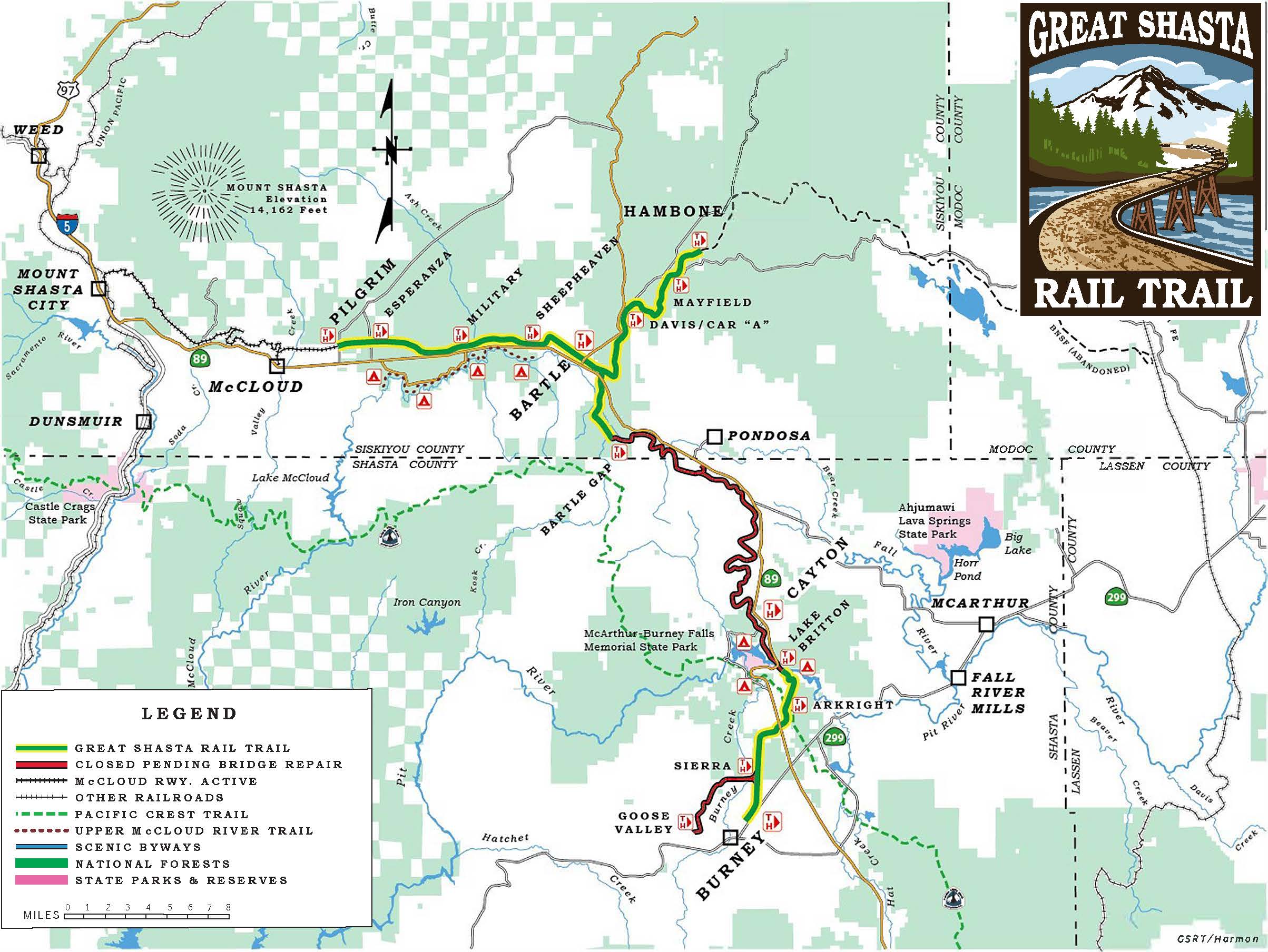
Linking the mountain towns of McCloud and Burney in northern California, the red cinder trail carried McCloud Railway lumber trains for over a century. The railroad ceased operations on these sections of the tracks in 2006, making possible this recreational asset.
Local Transportation


